The only two SRMSC components still in operation are the water supply system and the Perimeter Acquisition Radar (now the PARCS at Cavalier Air Force Station).
In addition to providing water for Cavalier Air Force Station, the former "ABM pipeline" furnishes water to several local water districts.
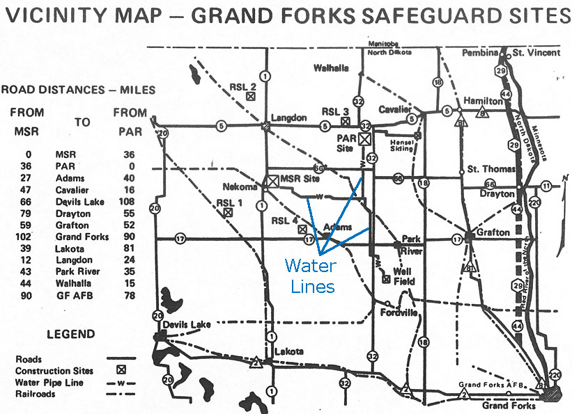
According to a comment from Joseph Hullender, the water lines were buried 8 feet deep.
This excerpt from Historic American Engineering Record, HAER No. ND-9 provides additional information:
C. Construction/Engineering
4. Materials / Water Supply System
......In late 1967, a search began for an adequate water supply for the planned project; a supply that would not impinge the limited resources of the local small communities. The result was the development, by late 1968, of a well field in the Fordville aquifer, a twenty square mile aquifer located some four miles north of the community of Fordville in Walsh County, some 33 air miles south east of the MSR site. The water system, sometimes referred to as the seventh SRMSC site, consists of ten noncontiguous wells scattered over 3.35 miles (each wellhead containing about a quarter acre of property) and three booster pumping stations with their associated 100,000 gallon storage tanks (each station comprising over an acre of land). This was the water source supply for the coolant system through a 93 km (58 mi) water line capable of delivering 3,785 liters (1,000 gallons) of water per minute as required for the project.