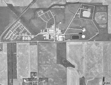
USGS high altitude aerial photo of the entire MSR site (1990).
The northern edge of the village of Nekoma is visible at the bottom of the photo.